“Yo-ho, yo-ho, it’s off to the fields of lava we go. We’ll take some pork rinds and a raspberry pie and we won’t be back til the Fourth of July!”---BK
An innocent pilgrim wiggling down the road from Carey, Idaho east toward the undistinguished hamlet of Arco might gather his wits about him as the landscape mumbles and begins to darken. “What’s all this?” he may wonder, abruptly pulling his map from its sheath, checking the route to see if cartographers have marked off a spot where “Demons Be Here!”
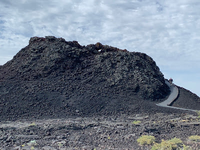
The wary traveler has unknowingly drifted into a twilight zone, a vast portion of southern Idaho’s Great Rift volcanic zone, an expanse that stretches out to the south and east as far as the eye can see. He has stumbled onto Craters of the Moon National Monument, an extraordinary lava field which covers approximately 1100 square miles on the Snake River Plain. The Great Rift begins north of the monument, about 6 miles from the topographic edge of the Snake River Plain and extends southeasterly for more than 50 miles to an area beneath Pillar Butte on the Wapi lava field. The rift zone is a belt of open cracks, eruptive fissures, shield volcanoes and cinder cones unparalleled anywhere. The Eldhraun Lava Field in Iceland is considered the largest lava flow in the world, a mere 218 square miles by comparison.
Being roughly in the middle of nowhere, Craters of the Moon is not overrun by chubby tourists in shorts and sandals. Less than two dozen prowled through the visitor center in the time it took us to watch a 20-minute film, with another 60 or 70 meandering around the lava cones outside, accessible via a winding road which snakes through the monument.
Craters of the Moon was formed during eight major eruptive periods between 15,000 and 2000 years ago. Lava emerged from the Great Rift, a series of deep cracks which begin near the visitor center and stretch 52 miles to the southeast. During this time, Craters of the Moon lava field grew to cover 618 square miles. The smaller Wapi and King’s Bowl lava fields also formed along the Great Rift during the most recent eruptive period (about 2000 years ago).
The volume of past eruptive events suggests that slightly over one cubic mile of lava will be dispersed during the next event, which is expected to begin along the central portion of the Great Rift inside the monument but may propagate to the northern section in the proximity of the loop road. Eruptions from potential vents on the northern part of the Great Rift may be explosive and could produce significant amounts of tephra—airfall material ejected from a volcano. Such eruptions would likely destroy cinder cones by both explosion and collapse, then build new ones. It is virtually impossible to predict a time span for future eruptions, but management suggests you let them know when you are coming and they’ll see what they can do.
On To Rexburg! Say What?
Speaking of shield volcanoes, the city of Rexburg, Idaho rests right on top of one. Eruptions are not expected in the area anytime soon, but who knows? The Mormons may have some secret information about all this because they’re flocking to the area, building sedate housing units and installing temples lickety-split. The relatively new Brigham Young University-Idaho sits smack in the middle of one of these volcanoes so maybe the LDS Church got the property cheap. At any rate, 95% of the Rexburg population is Mormon. More important, Rexburg leads the country in the number of pet schnauzers per capita. There is one of the critters for every 6.12 people in town. Before you go off worrying about a secret LDS conspiracy to corner the schnauzer market, the next highest schnauzer city is Orono, Maine. There are approximately no Mormons in Orono. The mystery deepens.
 |
| (1) Siobhan, over the boardwalk, down by the sea of lava; (2) A lovely Spatter Cone; (3) Giant lava rock about to collapse on unwary tourist. |
Has Anybody Here Seen Spencer?
“Yo-ho, yo ho, it’s off to the opal fields we go! We’ll take a good map and a compass or two since where the place is we haven’t a clue.”---BK
We overnighted in glamorous Rexburg because facilities in Spencer, site of Siobhan’s opal mines, do not exist. Matter of fact, according to all the maps we could find, neither does Spencer. Astute detectives that we are, however, we eventually managed to track the place down. You’re not going to believe this but we were the first customers of the day, just like at the Eagle City gold mine. The opals are sequestered in a gigantic rockpile just behind the owner’s cozy cafe, which, by the way, makes a mean cinnabon (bigger than a pieplate, more sugar than Dolly Parton).
Siobhan might not know much about opal-hunting but she learns things fast. When we were at Fenway Park recently, she probably knew as much about baseball as 20% of the sophisticated New England crowd, having gleaned a raft of information from watching UF softball. She is nonetheless disappointed that baseball does not allow fat men to be replaced on the basepaths by sleek young sprinters and subsquently return to the game. We’re beginning to see her side of the argument, but we digress.
The fee to search for opals is a very reasonable $20, but the same levy on innocent photographers (me) is outrageous. Or it would be if the nice lady and her family who own the place weren’t floating barely above the Mendoza Line for income. Siobhan took her hammer and gem bucket and headed for the mother lode, picking over and poking suspect rocks trying to identify the little buggers. After about ten minutes, Leo, the teenaged mutant ninja son of the owner, came out to lend a hand. Leo is like an attack eagle—he can spot a tiny opal at 100 yards with his eyes closed. He taught Siobhan some tricks of the trade and pretty soon she was finding her own gems. This revelry continued on for roughly an hour, or until Siobhan’s bucket got pretty heavy. We had to arm-wrestle Leo’s mother to leave him a $20 tip (she said it wasn’t good manners to accept largesse, but we weren’t going to buy seven cinnabons); fortunately, we were in better shape. The lady gave us clear directions on the two ways to get to Yellowstone: (1) a 150-mile glide over exemplary highways, or (2) a squiggly bouncealong over 75 miles of narrow gravel byways. Do we even need to tell you which route was chosen? We didn’t think so.
 |
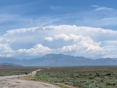
| (1) The Road to Rexburg; (2) Exotic Spencer opal mine; (3) Leo the Great and rookie hunter; (4) Working in the Opal Fields of The Lord. |
The Road To Yellowstone
“Yo-ho, yo ho, it’s off to the Yellowstone geysers we go! We’ll drive on a road where the antelope roam and hope to arrive ‘ere the cattle get home.”---BK
“It’s a long and dusty road, it’s a hot and a heavy load, and the cows you meet ain’t always kind.”---Tom Paxton
Siobhan, of course, argued for the superhighway, which has absolutely no chance of providing blog fodder, but some of us have work to do. Besides, the gravelway was half the distance--how bad could it be? Well….
The first ten miles of hard-packed gravel were just fine, thank you, but eventually the road narrowed, the gravel loosened and Bill started wondering what he might tell the rental car man if the little rocks kicked up by the front tires start pockmarking the nice Nissan. Before long, there was a pronounced peak in the center of the highway, obviously created by a road-grader somewhere down the line. As mentioned in a previous Pie installment, our vehicle didn’t take to anything higher than six inches popping up on the road, so we gravitated to the right even when the road didn’t.
Eventually, we ran across the culprit working on the road. Siobhan asked for a consultation. The driver peeked out of his large yellow machine and assured us the going down the line was satisfactory, but I think I saw him giggling up his sleeve as we pulled away. The pathway alternated between hard ground and loose gravel for much of the way before we reached a surface which looked suspiciously like dirt. And then, just to confirm our suspicions, a dust cloud appeared a couple of miles ahead. If we didn’t know better, it looked like there might be a herd of cows on the road in the distance, but that was silly, right? What would a mess of cattle be doing on a perfectly respectable highway?
 |
| (1) Beginning of the gravel road out of Spencer; so far, so good; (2) Gravel turns to dirt; roadblock ahead; (3) The lowing herd winds slowly o'er the lea. |
“Git Along, Little Dogie!” Big Dogie, Too.
Now, it’s not like we’ve never seen a cattle drive, but aren’t they supposed to travel over hill and dale across land which provides something to eat? Not this one. Just a few hundred feet ahead, at least a couple hundred Angus cattle shuffled down the highway and the modest ditches on each side, surrounded by a half-dozen or so cowboys twirling lassos, goosing laggards and shouting words of encouragement to the loudly complaining herd. They appeared to care not one whit when they saw our vehicle come nudging along. Siobhan, of course, was out of the car by this time taking videos. “How do you like my road NOW?” I asked with smug satisfaction. “It’s getting better,” she admitted.
About to reach the back of the aggregation, I rolled the window down and asked a mounted member of the rear guard what was the proper etiquette here. “Just meander on through,” he advised, with a big smile. Meander, right. I could do that. After I had meandered a reasonable distance with unhappy bovines baying loudly on both sides, a young cowpoke darted boldly to the center of the road and began to aggressively create an aisleway through the cattle, sort of like Moses parting the Red Sea. We eventually broke on through to the other side, just like Jim Morrison told us to do back in 1967. Waving goodbye the gang, we assured ourselves it would be all downhill from here. Five miles later, we stopped to let a tour group of a dozen riders on horses cross the avenue. Then, as if by magic, the blessed Highway 20 appeared in all its radiant splendor and the access to West Yellowstone was assured. Siobhan looked down at her timepiece. “It took just as long to navigate your short route as it would have to go on the highway,” she said, somewhat unkindly.
Ah, these young pups, unfortunate never to have heard the stirring words of The Lettermen: “The New Year’s Eve we did the town, the day we tore the goal post down. We will have these moments to remember.” The quiet walks, the noisy fun, the day when we were overrun, we will have these cattle to remember.
 |
| (1) Highway hijinks--it goes with the territory. |
Next Week: Return To Yellowstone
‘Twas over a dozen years ago we first cast eyes on Teddy Roosevelt’s first National Park, a wonder for the ages with its spouting geysers, rampaging waterfalls, wide-roaming bison herds, endless hiking opportunities. Has anything changed in the interim? Surprisingly, yes. Tune in next week as The Flying Pie sees all, tells all.
That’s all, folks….
bill.killeen094@gmail.com


